Explore items from Polynesia
Explore and reconnect with items and images from Polynesia.
Showing 99356 items from Polynesia
Filter by
-
 Cook Islands, Land Use Map of Aitutaki, Land Use of the Cook Islands Series No. 1, 1:7 920, 1968Australian National University LibraryMap Cook Islands Papua New Guinea 1968 to 2023
 -
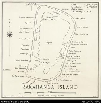 Cook Islands, Rakahanga Island, 1:12 000, 1961Australian National University LibraryMap Cook Islands Papua New Guinea 1961 to 2023
 -
 Cook Islands, Land Use Map of Atiu (Reverse), Land Use of the Cook Islands Series No. 1, 1:12 000, 1972Australian National University LibraryMap Cook Islands Papua New Guinea 1972 to 2023
 -
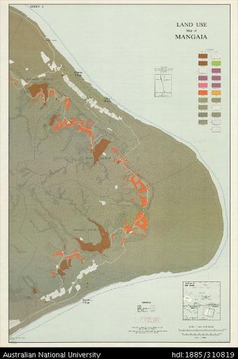
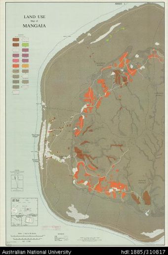 Cook Islands, Land Use Map of Mangaia, Land Use of the Cook Islands Series No. 1, Sheet 1, 1:7 920, 1971Australian National University LibraryMap Cook Islands Papua New Guinea 1971 to 2023
 -
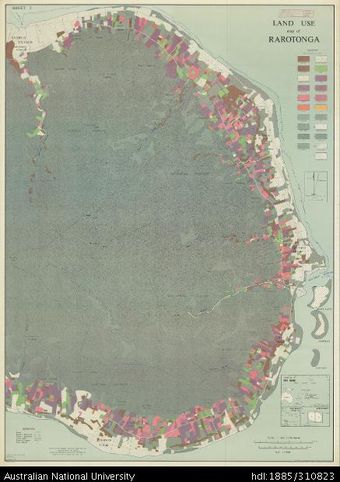
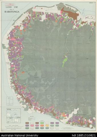 Cook Islands, Land Use Map of Rarotonga, Land Use of the Cook Islands Series No. 1, Sheet 1, 1:7 920, 1971Australian National University LibraryMap Cook Islands Papua New Guinea 1971 to 2023
 -
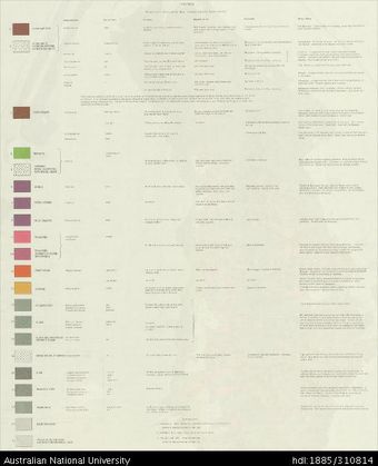
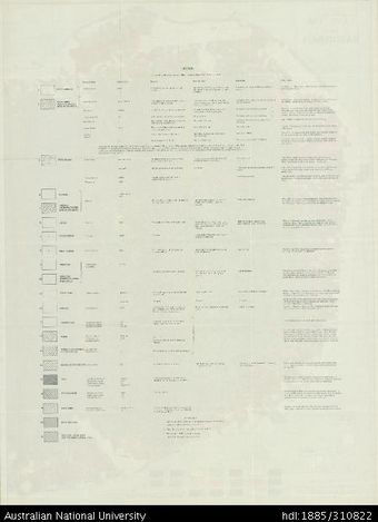
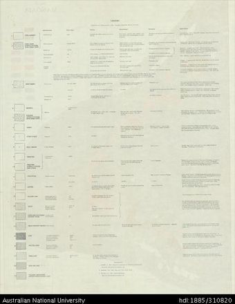
 Cook Islands, Land Use Map of Mangaia - Legend, Land Use of the Cook Islands Series No. 1, Sheet 1, 1971Australian National University LibraryMap Cook Islands Papua New Guinea 1971 to 2023
 -
 Cook Islands, Land Use Map of Mangaia, Land Use of the Cook Islands Series No. 1, Sheet 2, 1:7 920, 1971Australian National University LibraryMap Cook Islands Papua New Guinea 1971 to 2023
 -
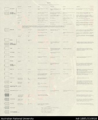
 Cook Islands, Land Use Map of Rarotonga - Legend, Land Use of the Cook Islands Series No. 1, Sheet 1, 1971Australian National University LibraryMap Cook Islands Papua New Guinea 1971 to 2023
 -
 Cook Islands, Land Use Map of Rarotonga, Land Use of the Cook Islands Series No. 1, Sheet 2, 1:7 920, 1970Australian National University LibraryMap Cook Islands Papua New Guinea 1970 to 2023
 -
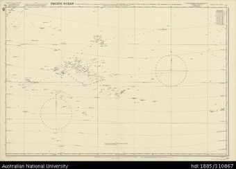 Pacific Ocean (in four sheets), Admiralty Chart, Sheet 783, South East, 1875, 1:6 900 000Australian National University LibraryMap Easter Island / Rapa Nui 1960 to 2023
 -
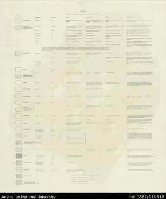
 Cook Islands, Land Use Map of Mangaia - Legend, Land Use of the Cook Islands Series No. 1, Sheet 2, 1971Australian National University LibraryMap Cook Islands Papua New Guinea 1971 to 2023
 -
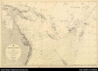 Pacific Ocean (in four sheets), Admiralty Chart, Sheet 780 South West, 1954, 1:6 900 000Australian National University LibraryMap Easter Island / Rapa Nui 1954 to 2023
Results per page
Welcome and warm Pasifik greetings
The information on this site has been gathered from our content partners.
The names, terms, and labels that we present on the site may contain images or voices of deceased persons and may also reflect the bias, norms, and perspective of the period of time in which they were created. We accept that these may not be appropriate today.
If you have any concerns or questions about an item, please contact us.