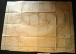
Map - Hawaii
- Description:
- Map - paper - Hawaiian or Sandwich Islands 1510. From the United States Government Charts to 1930 Nihoa from an Hawaiian Government Chart of 1885. The names of the islands engraved in hairline within brackets are the original names assigned by Captain Cook in 1779. Published at the Admiralty 9th April 1881 under the Superintendent of Captain ...
- Location:
- Hawaiʻi
- Collections:
- MOTAT
- Content partner:
- MOTAT
- Availability:
- Not specified
-
Copyright status: All rights reservedFind out more about what you are able to do with this itemThis item is all rights reserved, with means you'll have to get permission from MOTAT before using it. For more information, please see our use and reuse page.What can I do with this item?Non-infringing useNZ copyright law does not prevent every use of a copyright work, and this item may be hosted by an international institute or organisation. You should consider what you can and cannot do with a copyright work.No sharingYou may not copy and/or share this item with others without further permission. This includes posting it on your blog, using it in a presentation, or any other public use.No modifyingYou are not allowed to adapt or remix this item into any other works.No commercial useYou may not use this item commercially.
Welcome and warm Pasifik greetings
The information on this site has been gathered from our content partners.
The names, terms, and labels that we present on the site may contain images or voices of deceased persons and may also reflect the bias, norms, and perspective of the period of time in which they were created. We accept that these may not be appropriate today.
If you have any concerns or questions about an item, please contact us.


